On the last Sunday of January, David, Ryan, I set out for a hike in the Columbia River Gorge. Ryan doesn’t have any experience with the gorge – except for a young memory of hiking up to the top of Multnomah Falls in the spring of 2014. David and I only have a couple gorge hiking experiences beyond that ourselves, and so we were pretty much starting from scratch as we looked at possibilities for this particular day. It didn’t take us long to settle in on the Eagle Creek Trail – evidently a very popular trail that would be hopefully less crowded on this ice cold afternoon.
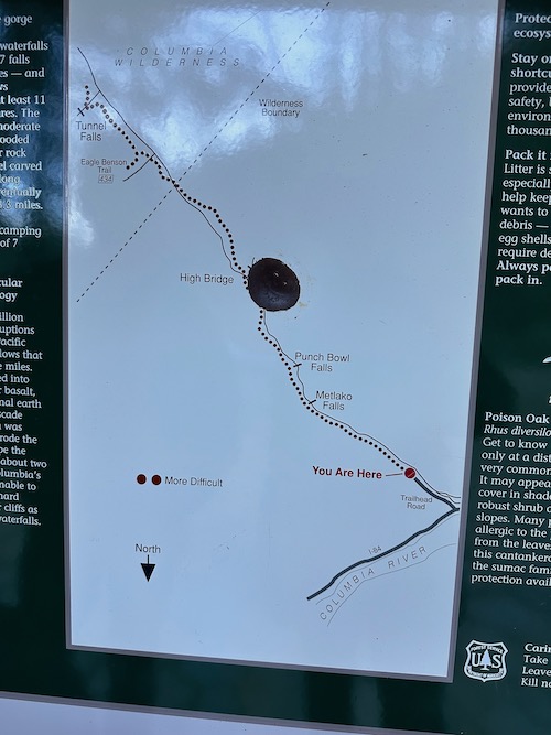
The trailhead has a small parking lot for maybe 20? vehicles and it was full when we arrived about 2:30p so we backtracked to the also very small lot about .25mile back and easily found a spot there. (NW Forest Pass Required) By the time we parked and walked to the trailhead, a couple spots right by the trailhead opened up. All that to say, there were people but it wasn’t overwhelming, as the online reports indicate it can be in warmer weather seasons.
We had read about the trail when we chose it, but only took along very limited specific information as we set out. Consequently, we didn’t know the names of the landmark features we saw along the way, but we were able to easily piece it together later.
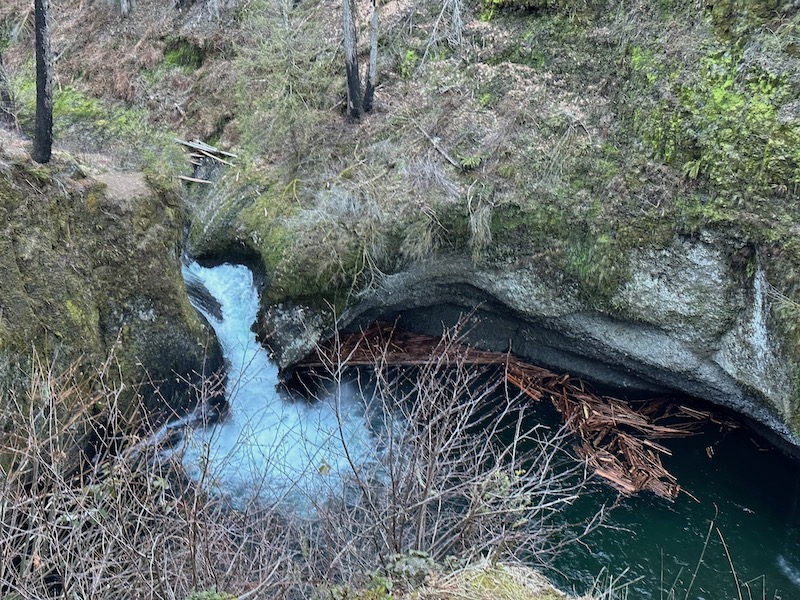
We were on the lookout for iconic Punchbowl Falls – it is the subject of so many pictures from Gorge area hikes!! But, I thought it was 4 miles out on the trail. Not having read trail info closely enough, I missed the fact that 4 miles = Round Trip. So when we came to a sign, a couple miles along that pointed off the trail with the label, Lower Punchbowl Falls, we took the quick .25 mile jaunt down to the water.
At the time, we didn’t quite know what we were looking at. Later I found this to be an excellent summary from Oregon Hikers: Lower Punch Bowl Falls has a bit of an identity problem. The waterfall is ever overshadowed by its upstream neighbor, Punch Bowl Falls.
After hanging out here at water’s edge for a few minutes, we went back up to the main trail and continued on, still keeping watch for Actual Punchbowl Falls, expecting it much further down the trail.
When we got home and looked at pictures and compared notes with trail information, it turns out we did indeed find Punchbowl Falls. Right where it was supposed to be, we just didn’t know it.
Additionally, we were keeping watch for Metlako Falls, which supposedly could be seen BEFORE Punchbowl Falls (see the trailhead map in my photo above). I had received a gorgeous photo of Metlako Falls for Christmas and I knew it was along this trail. I hoped to see for myself. However, unfamiliar with landmarks and trail history, we didn’t know where to look. When we got home later, I traced our trek more closely with information available online and learned that Metlako Falls would have been seen just 1.5 miles from the trailhead – before the Lower Punchbowl Falls side trail, and if we could see it at all, we certainly didn’t know to watch for it there. The main Metlako Falls viewpoint got washed out in 2016.
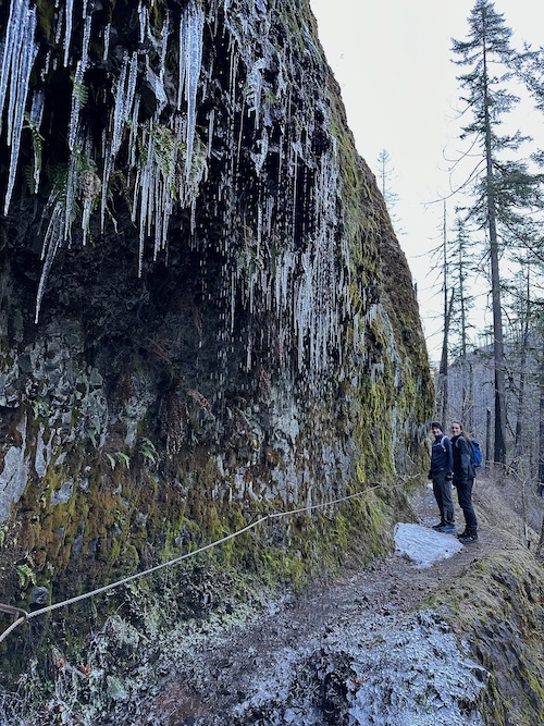
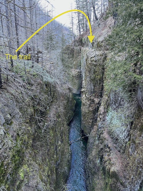
Never mind that we didn’t know the names of what we were looking at as we hiked out and back–it was EASY to recognize the beauty every direction!! As soon as I got out of the car at the trailhead, I announced how glad I was to have come. In spite of all the evidence of recent fire impacts, what a gorgeous trail right from the start! We traveled a narrow path that was often carved out of the rock walls with really steep, long drop offs into the canyon at one side, and the footing was periodically icy, but there were cables bolted into into the rock wall along the most treacherous spots. (It was interesting to look at our pictures when we got home and find that you couldn’t really tell from them how high up we were and how steep the drop offs were.)
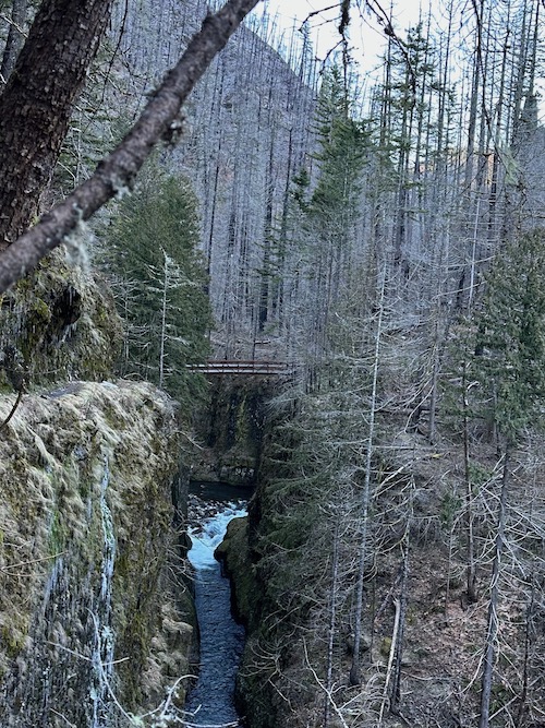
We for sure didn’t want to get caught out there on that tricky trail in the dark so we turned back with enough time to return before sunset. This meant that we got out to what turned out to be Skoonichuck Falls, which is just beyond a high bridge, which turned out, in fact, to be High Bridge.

and then turned and traced our way back on the trail.
We got back to the car about 5p (having walked 9.16miles RT), and caught a beautiful sunset on the Columbia River as we drove back toward Portland.
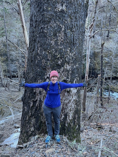
One more note because it’ll serve as the launch for my next post – While we were out there, I kept commenting on the great big trees and recalled how one of my most memorable childhood trips was when our family went down to California and our way back from San Francisco, we DROVE THROUGH a Redwood Tree with our great big green station wagon. I was pretty sure I had a picture of that remarkable occasion, so when we got home from our Eagle Creek hike, I went looking……..
 Green River Soda